-
উপজেলা সম্পর্কিত
উপজেলা পরিচিতি
ইতিহাস ও ঐতিহ্য
ভৌগলিক ও অর্থনৈতিক
ইউনিয়ন
অন্যান্য
-
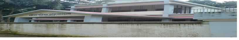
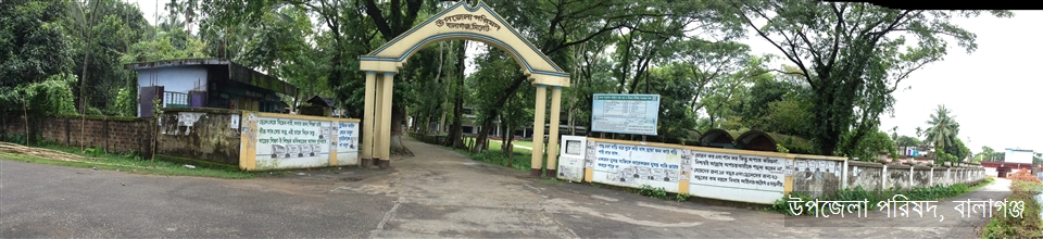
উপজেলা পরিষদ
জনপ্রতিনিধি
পরিকল্পনা ও প্রতিবেদন
মাসিক উন্নয়ন সমন্বয় সভা
নাগরিক সনদ
কর্মচারীবৃন্দ
বিভিন্ন কমিটির সভা
-
আইন শৃঙ্খলা বিষয়ক কমিটি
-
জন্ম ও মৃত্যু নিবন্ধন টাস্কফোর্স কমিটি
-
যোগাযোগ ও ভৌত অবকাঠামো উন্নয়ন বিষয়ক কমিটি
-
কৃষি ও সেচ বিষয়ক কমিটি
-
মাধ্যমিক ও মাদ্রাসা শিক্ষা বিষয়ক কমিটি
-
প্রাথমিক ও গণশিক্ষা বিষয়ক কমিটি
-
স্বাস্থ্য ও পরিবার কল্যাণ বিষয়ক কমিটি
-
যুব ও ক্রিড়া উন্নয়ন বিষয়ক কমিটি
-
নারী ও শিশু উন্নয়ন বিষয়ক কমিটি
-
সমাজ কল্যাণ বিষয়ক কমিটি
-
মুক্তিযোদ্ধা বিষয়ক কমিটি
-
মৎস্য ও প্রাণীসম্পদ বিষয়ক কমিটি
-
পল্লী উন্নয়ন ও সমবায় বিষয়ক কমিটি
-
সংস্কৃতি বিষয়ক কমিটি
-
বাজার মূল্য পর্যবেক্ষণ, মনিটরিং ও নিয়ন্ত্রণ কমিটি
-
অর্থ, বাজেট, পরিকল্পনা ও স্থানীয় সম্পদ আহরণ বিষয়ক কমিটি
-
জনস্বাস্থ্য, স্যানিটেশন ও বিশুদ্ধ পানি সরবরাহ বিষয়ক কমিটি
-
পরিবেশ ও বন বিষয়ক কমিটি
তথ্য প্রদানকারী কর্মকর্তা
-
আইন শৃঙ্খলা বিষয়ক কমিটি
-
উপজেলা প্রশাসন
উপজেলা নির্বাহী কর্মকর্তা
উপজেলা নির্বাহী কর্মকর্তার কার্যালয়
এ্যাপয়ন্টমেন্ট ও সভা
সেবা ও অন্যান্য
- ইউনিয়ন
-
সরকারি অফিস
আইন-শৃঙ্খলা বিষয়ক
স্বাস্থ্য বিষয়ক
কৃষি ও খাদ্য বিষয়ক
ভূমি বিষয়ক
প্রকৌশল ও তথ্য যোগাযোগ প্রযুক্তি
মানব সম্পদ উন্নয়ন বিষয়ক
-
অন্যান্য প্রতিষ্ঠান
শিক্ষা প্রতিষ্ঠান
- গ্যালারী
-
ই-সেবা
জেলা ই-সেবা কেন্দ্র
জাতীয় ই-সেবা
-
উপজেলা সম্পর্কিত
উপজেলা পরিচিতি
ইতিহাস ও ঐতিহ্য
ভৌগলিক ও অর্থনৈতিক
ইউনিয়ন
অন্যান্য
-
উপজেলা পরিষদ
প্রশাসক
জনপ্রতিনিধি
পরিকল্পনা ও প্রতিবেদন
মাসিক উন্নয়ন সমন্বয় সভা
নাগরিক সনদ
কর্মচারীবৃন্দ
বিভিন্ন কমিটির সভা
- আইন শৃঙ্খলা বিষয়ক কমিটি
- জন্ম ও মৃত্যু নিবন্ধন টাস্কফোর্স কমিটি
- যোগাযোগ ও ভৌত অবকাঠামো উন্নয়ন বিষয়ক কমিটি
- কৃষি ও সেচ বিষয়ক কমিটি
- মাধ্যমিক ও মাদ্রাসা শিক্ষা বিষয়ক কমিটি
- প্রাথমিক ও গণশিক্ষা বিষয়ক কমিটি
- স্বাস্থ্য ও পরিবার কল্যাণ বিষয়ক কমিটি
- যুব ও ক্রিড়া উন্নয়ন বিষয়ক কমিটি
- নারী ও শিশু উন্নয়ন বিষয়ক কমিটি
- সমাজ কল্যাণ বিষয়ক কমিটি
- মুক্তিযোদ্ধা বিষয়ক কমিটি
- মৎস্য ও প্রাণীসম্পদ বিষয়ক কমিটি
- পল্লী উন্নয়ন ও সমবায় বিষয়ক কমিটি
- সংস্কৃতি বিষয়ক কমিটি
- বাজার মূল্য পর্যবেক্ষণ, মনিটরিং ও নিয়ন্ত্রণ কমিটি
- অর্থ, বাজেট, পরিকল্পনা ও স্থানীয় সম্পদ আহরণ বিষয়ক কমিটি
- জনস্বাস্থ্য, স্যানিটেশন ও বিশুদ্ধ পানি সরবরাহ বিষয়ক কমিটি
- পরিবেশ ও বন বিষয়ক কমিটি
সাংগঠনিক কাঠামো
তথ্য প্রদানকারী কর্মকর্তা
-
উপজেলা প্রশাসন
উপজেলা নির্বাহী কর্মকর্তা
উপজেলা নির্বাহী কর্মকর্তার কার্যালয়
এ্যাপয়ন্টমেন্ট ও সভা
সেবা ও অন্যান্য
- ইউনিয়ন
-
সরকারি অফিস
আইন-শৃঙ্খলা বিষয়ক
স্বাস্থ্য বিষয়ক
কৃষি ও খাদ্য বিষয়ক
ভূমি বিষয়ক
প্রকৌশল ও তথ্য যোগাযোগ প্রযুক্তি
মানব সম্পদ উন্নয়ন বিষয়ক
-
অন্যান্য প্রতিষ্ঠান
শিক্ষা প্রতিষ্ঠান
-
গ্যালারী
ছবি
-
ই-সেবা
জেলা ই-সেবা কেন্দ্র
জাতীয় ই-সেবা
বালাগঞ্জ উপজেলার পটভূমিঃ
Background of Balaganj Upazila:
সাধারণ তথ্যাবলীঃ(General Information)
বালাগঞ্জ উপজেলা কুশিয়ারা নদীর তীরে সিলেট জেলার সর্ব দক্ষিণে অবস্থিত। এই উপজেলার উত্তরে সিলেট জেলার সদর উপজেলা, দক্ষিণে মৌলভীবাজার জেলা সদর ও রাজনগর উপজেলা, পূর্বে সিলেট জেলার ফেঞ্চুগঞ্জ উপজেলা, পশ্চিমে সিলেট জেলার বিশ্বনাথ এবং সুনামগঞ্জ জেলার জগন্নাথপুর উপজেলা অবস্থিত। এ উপজেলা প্রায় ২৪.৩৬● এবং ২৪.৪৭● অক্ষাংশ; ৯১.৩৮● এবং ৯১.৫৬● পূর্ব দ্রাঘিমাংশের মধ্যে অবস্থিত। জেলা হতে উপজেলাটির দূরত্ব ৩৭ কি:মি:।এ ৩৭৫.৭৫ বর্গকি:মি: এবং লোকসংখ্যা ২,৫৫,০৪০ জন(আদমশুমারি-২০০১)। -২ আসন সিলেট জেলার বালাগঞ্জ-বিশ্বনাথ গঠিত।
General Information:
The Upazila Balaganj stands on the river KUSHIARA and is on the southest periphery of Sylhet district. On the north, there is Sylhet Sadar(proper) Upazila, on the south, is Rajnagar and Sadar Upazila of Moulvibazar district, Fenchuganj Upazila of this district is on the east and on the west is Biswonath Upazila of this district and Jagannathpur Upazila of Sunamganj district. Geographically Balaganj Upazila is situated at about 24.36* and 24.47* longitude and 91.38* and91.56* east latitude. The distance of the Upazila headquarter(HQ) from the district HQ is nearly 37 kms. The land areais approximately 375.75sq kms and the population is 255040(Census-2001).
উপজেলা পরিচিতিঃ
বালাগঞ্জ উপজেলা কুশিয়ারা নদীর তীরে সিলেট জেলার সর্ব দক্ষিণে অবস্থিত। এই উপজেলার উত্তরে সিলেট জেলার সদর উপজেলা, দক্ষিণে মৌলভীবাজার জেলা সদর ও রাজনগর উপজেলা, পূর্বে সিলেট জেলার ফেঞ্চুগঞ্জ উপজেলা, পশ্চিমে সিলেট জেলার বিশ্বনাথ এবং সুনামগঞ্জ জেলার জগন্নাথপুর উপজেলা অবস্থিত। এ উপজেলা প্রায় ২৪.৩৬● এবং ২৪.৪৭● অক্ষাংশ; ৯১.৩৮● এবং ৯১.৫৬● পূর্ব দ্রাঘিমাংশের মধ্যে অবস্থিত। জেলা হতে উপজেলাটির দূরত্ব ৩৭ কি:মি:।এ ৩৭৫.৭৫ বর্গকি:মি: এবং লোকসংখ্যা ২,৫৫,০৪০ জন(আদমশুমারি-২০০১)। -২ আসন সিলেট জেলার বালাগঞ্জ-বিশ্বনাথ গঠিত।
Introduction to the Upazila:
The Upazila Balaganj stands on the river KUSHIARA and is on the southest periphery of Sylhet district. On the north, there is Sylhet Sadar(proper) Upazila, on the south, is Rajnagar and Sadar Upazila of Moulvibazar district, Fenchuganj Upazila of this district is on the east and on the west is Biswonath Upazila of this district and Jagannathpur Upazila of Sunamganj district. Geographically Balaganj Upazila is situated at about 24.36* and 24.47* longitude and 91.38* and91.56* east latitude. The distance of the Upazila headquarter(HQ) from the district HQ is nearly 37 kms. The land area is approximately 375.75sq kms and the population is 255040(Census-2001).
উপজেলার সৃষ্টি ও নামকরনের ইতিহাসঃ
বৃহত্তর সিলেট জেলার বর্তমান বালাগঞ্জ, ফেঞ্চুগঞ্জ এবং রাজনগর উপজেলা নিয়ে ১৮৮২ খ্রিস্টাব্দে বালাগঞ্জ থানা (পুলিশ স্টেশন) গঠিত হয়। ১৯২২ খ্রিস্টাব্দে গেজেট নোটিফিকেশন নং ১৭৬ তাং ১০/০১/১৯২২ মূলে বর্তমান বালাগঞ্জ উপজেলা এলাকা নিয়ে বালাগঞ্জ থানা পূণর্গঠিত হয়। পরবর্তীতে ৭ নভেম্বর, ১৯৮২ খ্রিঃ তারিখে বালাগঞ্জ থানা আপগ্রেডেড হয় এবংবালাগঞ্জ উপজেলায় রূপান্তরিত হয়।
এ উপজেলার ‘বালাগঞ্জ’ নামকরন নিয়ে গবেষকদের মধ্যে বিভিন্ন মত বিদ্যমান রয়েছে। কারো মতে এর আদি নাম ছিল ‘কুশিয়ারকূল’যা এখানকার প্রধান নদী কুশিয়ারা’র পারে উৎপাদিত ‘কুশিয়ার’ (আঁখ) থেকে আগত এবং এ নদীটিও সেজন্য কুশিয়ারা নামে পরিচিতি লাভ করে। পরবর্তীতে এখানে গড়ে ওঠা মদন মোহন জিউ আশ্রমের প্রভাবে নাম পরিবর্তীত হয়ে মদনগঞ্জ এবং তা থেকে বালাগঞ্জ নাম ধারণ করে। কথিত আছে, মদন মোহন জিউ আশ্রমের সেবায়িতগণ হাতে প্রচুর পরিমাণে ‘বালা’ (মহিলাদের হাতে পরার বিশেষ ধরণের চুড়ির মত অলঙ্কার যা স্বর্ণ এবং/অথবা ব্রোঞ্জ এর তৈরী) পরতেন এবং এর ফলে এখানে বিপুল পরিমাণে ‘বালা’ কেনা-বেচা হত বলেই বালাগঞ্জ নামকরন হয়। অনেকে মনে করেন গুরুত্বপূর্ণ নৌ-বন্দর হিসেবে এখানে ‘বালা বালা’ (ভাল ভাল –এর স্থানীয় রূপ) জিনিষপত্র পাওয়া যেত বলে এর নাম বালাগঞ্জ হয়েছে।
Brief History Of Establishment Of The Upazila And It’s Naming:
Balaganj Upazila was first constituted as aPolice Station(Balaganj Thana) including Balaganj, Fenchuganj and Rajnagar in 1882 AD. In 1922,Balaganj Thana got its new formation with its present territory vide gazette notification no.176 dated 10.01.1922. On 07 november 1982, Balaganj Thana wasup-graded and declared to be Balaganj Upazila.
The name of the Upazila ‘Balaganj’ comes out of several public opinions and hearsays that stand historically disputed among the researchers in this regard. Some guess the name originally was KUSHIARKUL after the local name of sugarcane KUSHIAR(Produced in plenty) that leads to the name of the adjacent river KUSHIARA and afterwards it takes the name MODONGANJ with the influence of MODON-MOHON JIU ASROM(a place for Hindu worship) located at Balagonj bazaar. The Sebaits(Worshipers) of the ASROM used to wear, on both the hands, a lot of BALA(circular band made of Bronze and/or Gold worn by women as an ornament over both the wrists) that caused a huge availability here of said special ornaments for sale-and-purchase that could have led the emergence of the name Balaganj. One hearsay sounds that BALA BALA(Very good in quality) things were sold here in Balaganj bazaar that might have reasoned the name of the Upazila BALAGANJ.


পরিকল্পনা ও বাস্তবায়নে: মন্ত্রিপরিষদ বিভাগ, এটুআই, বিসিসি, ডিওআইসিটি ও বেসিস
কারিগরি সহায়তায়:
![]()
সফটওয়্যার তৈরি: